Geography
Subject Overview
Over the course of the year pupils study a range of different topics and learn a variety of geographical skills. Each year group studies six different overarching strands which are: locational knowledge, place knowledge, human/physical geography, geographical skills and field work and vocabulary. Throughout each of our topics we incorporate cross curricular learning with links to writing, reading, science, history, RE, French, art, DT and computing. The geography curriculum in Saltergate is designed to recap on skills and knowledge previously learnt and build upon this knowledge as children progress through the school.
The school also celebrates Earth Day during the summer Term. Each class participates in a range of cross curricular activities designed to broaden the children’s knowledge of environmental issues. Pupils are also given a chance to apply to become a member of the Eco Council in school. Across the year pupils also join in with assemblies led by both teachers and year 6 children about different geographical issues and events. In many of the older year groups pupils watch 'Newsround' to help them keep abreast of world news and promote respectful discussion and debate. Geography is enriched through trips linked to topics covered and challenges set out through the Saltergate 500.
EYFS
Since 2021 the Early Years Foundation Stage (0-5years) have followed the new statutory framework for EYFS settings. The prime areas of learning and development are:
- communication and language
- physical development
- personal, social and emotional development
These three areas are enhanced and enriched through the following 4 areas:
- literacy
- mathematics
- understanding the world
- expressive arts and design
KS1
Year 1
In autumn term children draw a simple line map linked to The Little Red Hen book. They then study the continents of the Arctic, Africa and Asia-learning fascinating facts about the animals who live there.
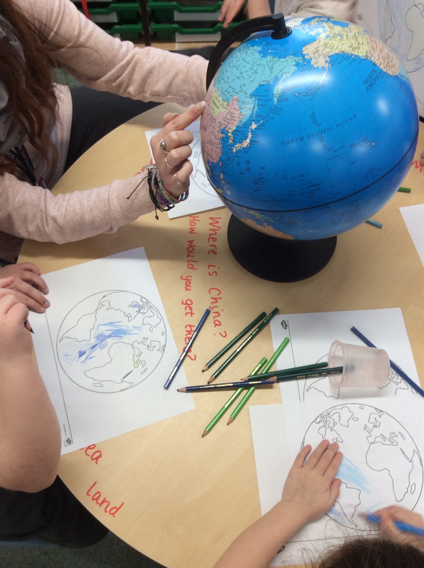
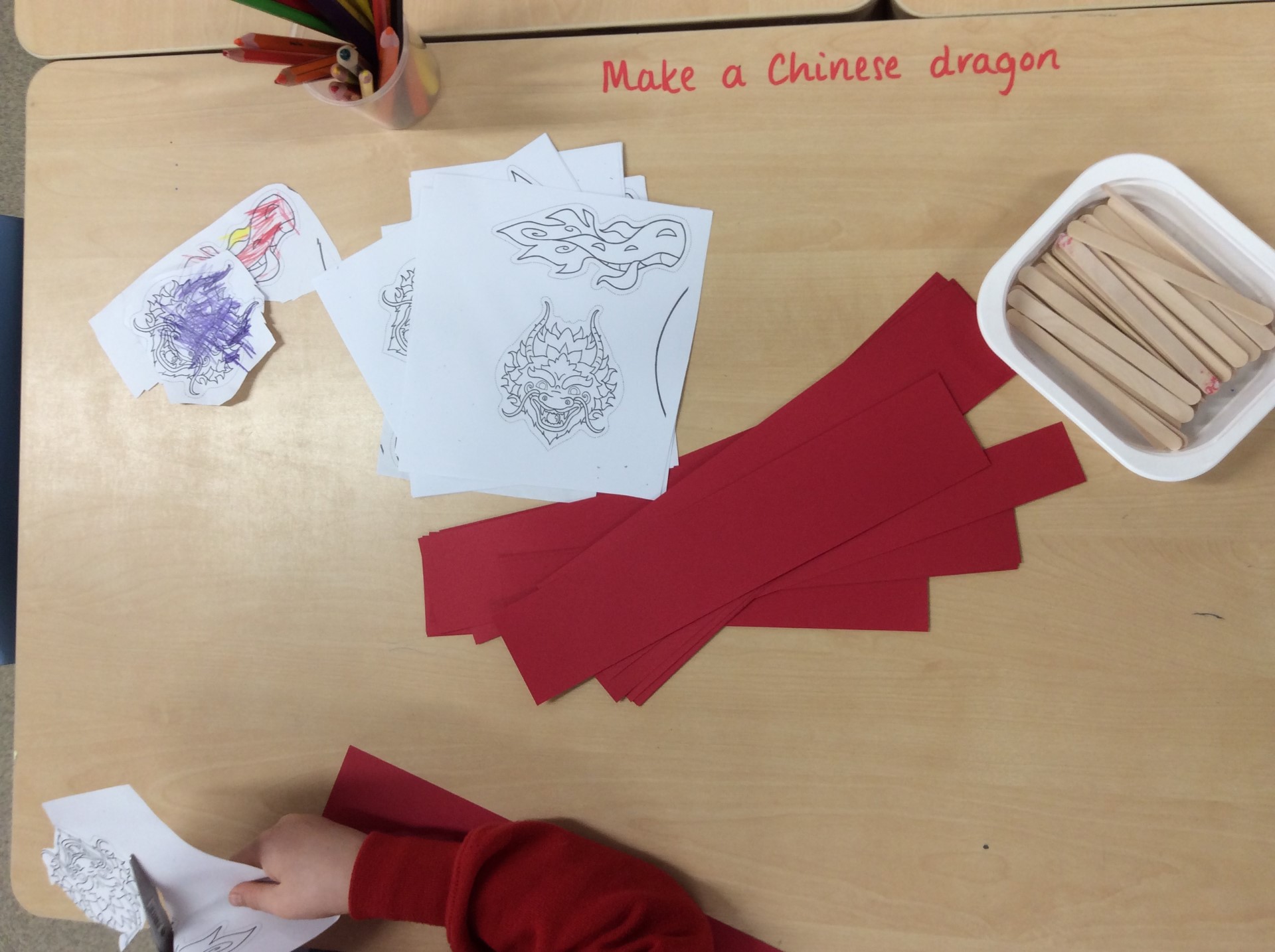
As part of a topic on transport in spring, children go on a ‘flight’ to China, where they have the opportunity to taste Chinese food and learn more about the country.
During the summer term children look at plastic pollution as part of ‘Earth Day’, as well as creating story maps linked to Traditional Tales. They also create a map of the school grounds.
Year 2
In autumn the classes recap on their learning from Year 1, before using compass directions to describe the location of features and routes on a map.
In spring Term pupils learn about the human and physical features of London, linking their learning with the Great Fire of London.
In the summer term children go on a local walk, creating their own map of the area. They then get to visit the seaside, allowing them to compare and contrast the human and physical features with Jennyfields.
Year 3
In spring Term children compare an area in the UK with an area in Europe. They also take part in a nature walk around the local area.
In the summer term, children start off by looking at different maps and their symbols before progressing to creating their own.
Year 4
In autumn Term children explore rivers and mountains both in the UK and around the world and how these features can shape a community.
In spring term children discover all about Australia through links to English children create fact files using the knowledge they have gained.
During the final term, children find out about volcanoes and earthquakes, with a focus on Pompeii.
Year 5
In the autumn term pupils learn all about the human and physical aspects of Scandinavia, which links to their topic on Vikings in history.
During spring pupils hone their map reading skills using Ordnance Survey maps, starting to use the eight compass points and four or six-figure grid references. Pupils also develop their orienteering skills around the school grounds to achieve one of the Saltergate 500 challenges.
In the summer term children study South America, with their learning culminating in a carnival day.
Year 6
In autumn children study biomes from around the world, identifying their specific features. They then combine their knowledge with DT to create biome boxes out of shoeboxes, complete with biome facts.
During the year 6 residential to Water Park in the Lake District pupils gain real experiences of different landscapes and develop their map reading skills through orienteering activities.
In spring, they start a topic about North America and the ring of fire. This links back to their previous learning about volcanoes in year 4. They also study the Day of the Dead carnival which takes place in Mexico.
Later on in the year their map reading skills are further refined when pupils plan a walk using Ordnance survey maps to Valley Gardens for their ‘Pizza in the Park’ trip.